

National Geographic Map – “Atlantic Canada” (October 1993) | Vintage Cartographic Supplement
National Geographic Map – “Atlantic Canada” (October 1993) | Vintage Cartographic Supplement
Regular price
$15.00 USD
Regular price
Sale price
$15.00 USD
Unit price
per
Shipping calculated at checkout.
Couldn't load pickup availability
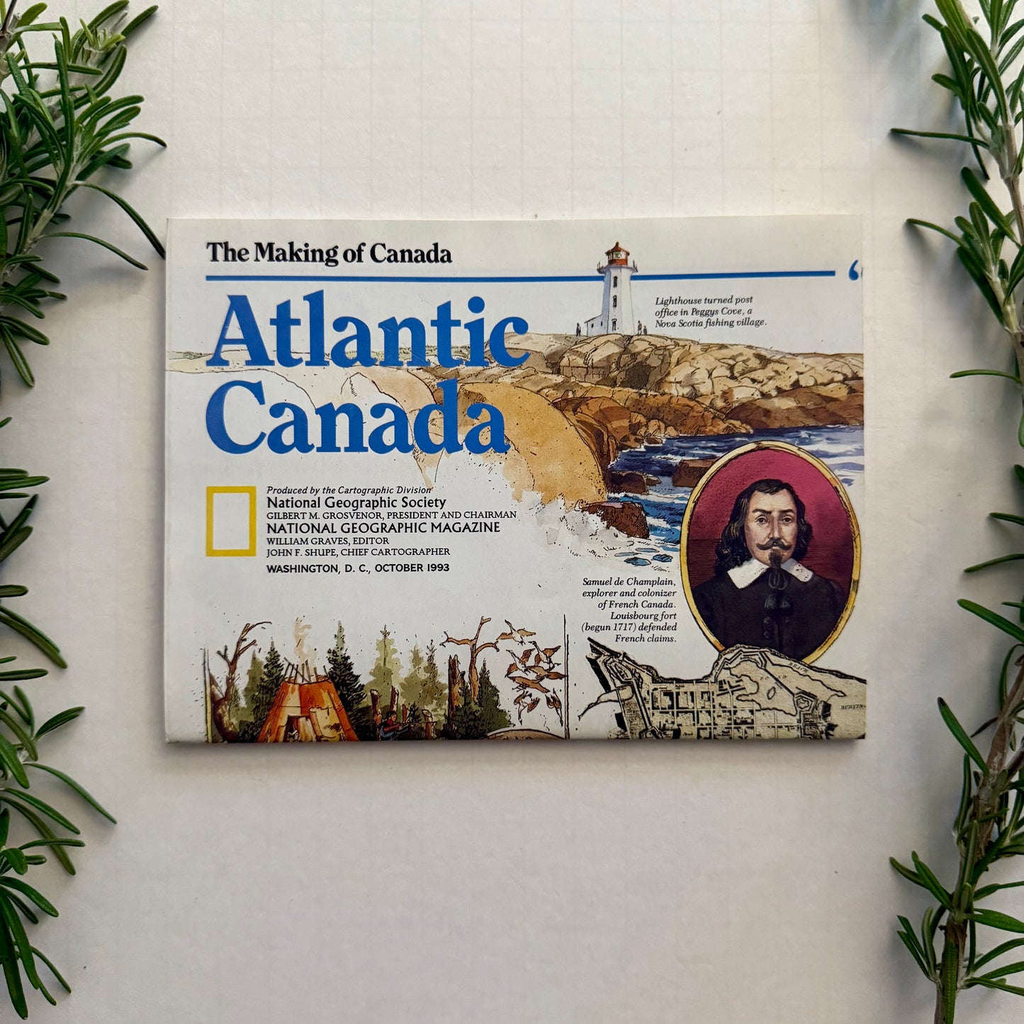
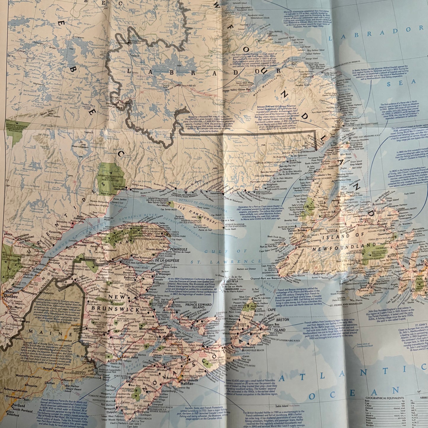
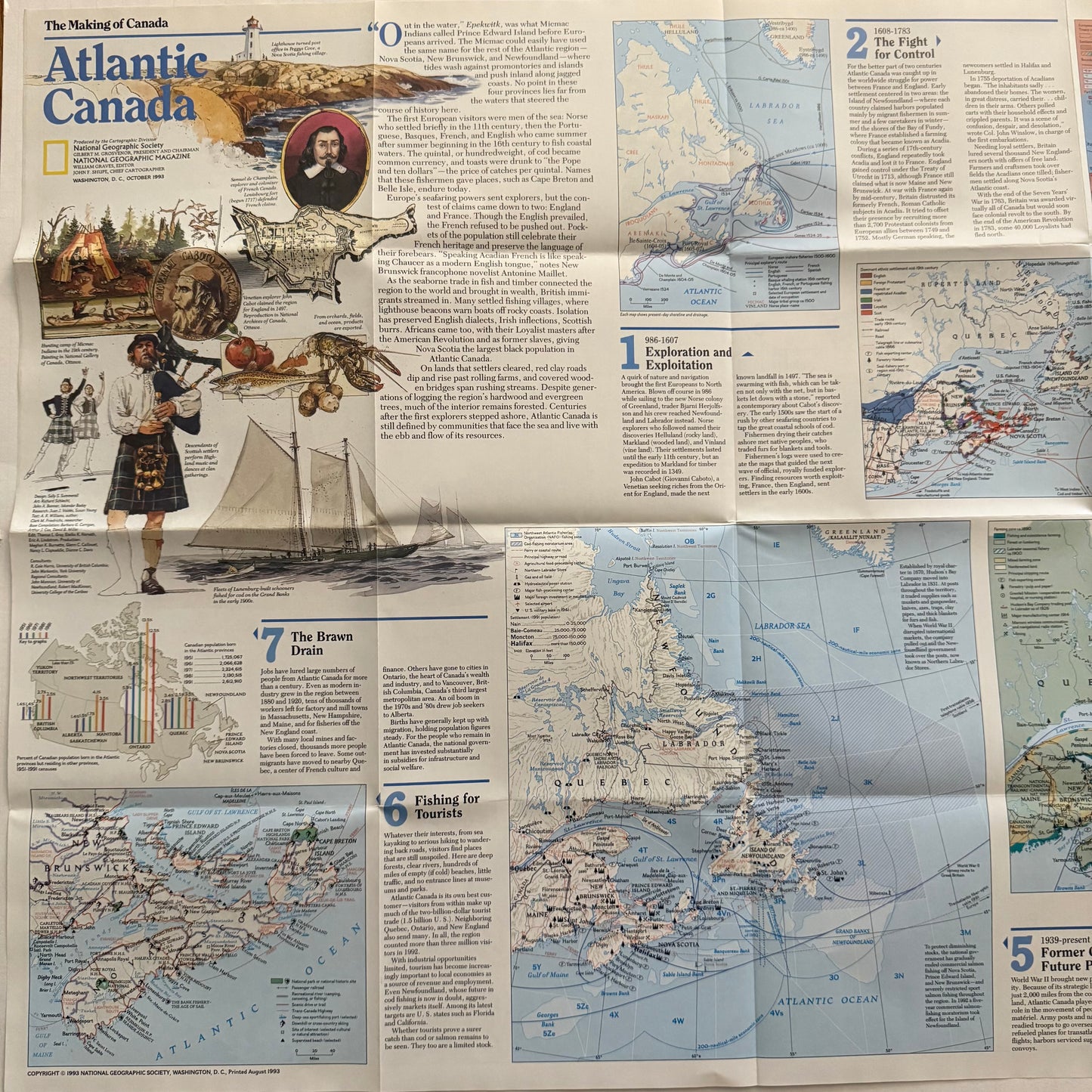
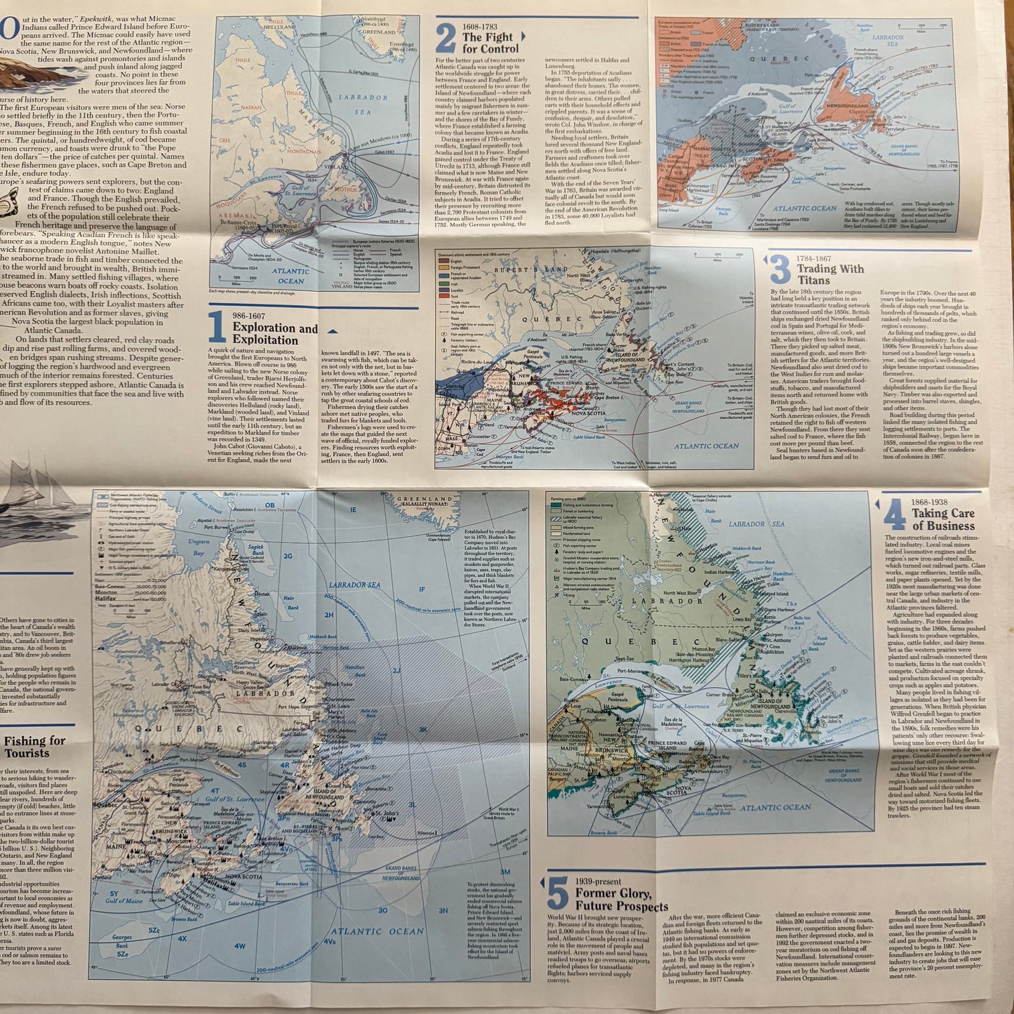
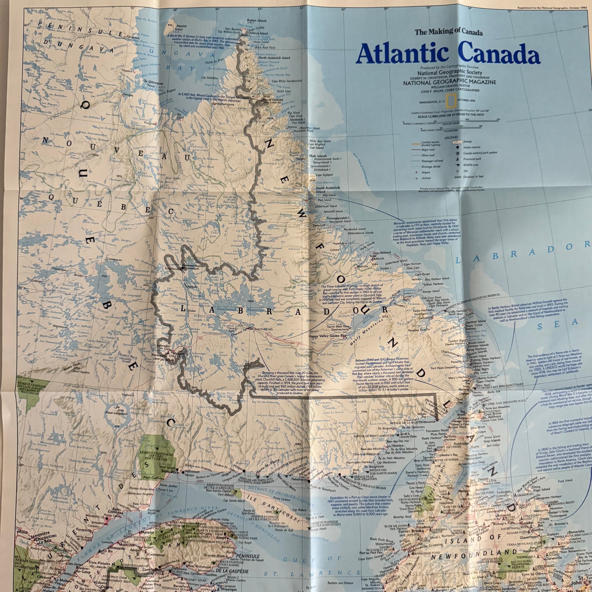
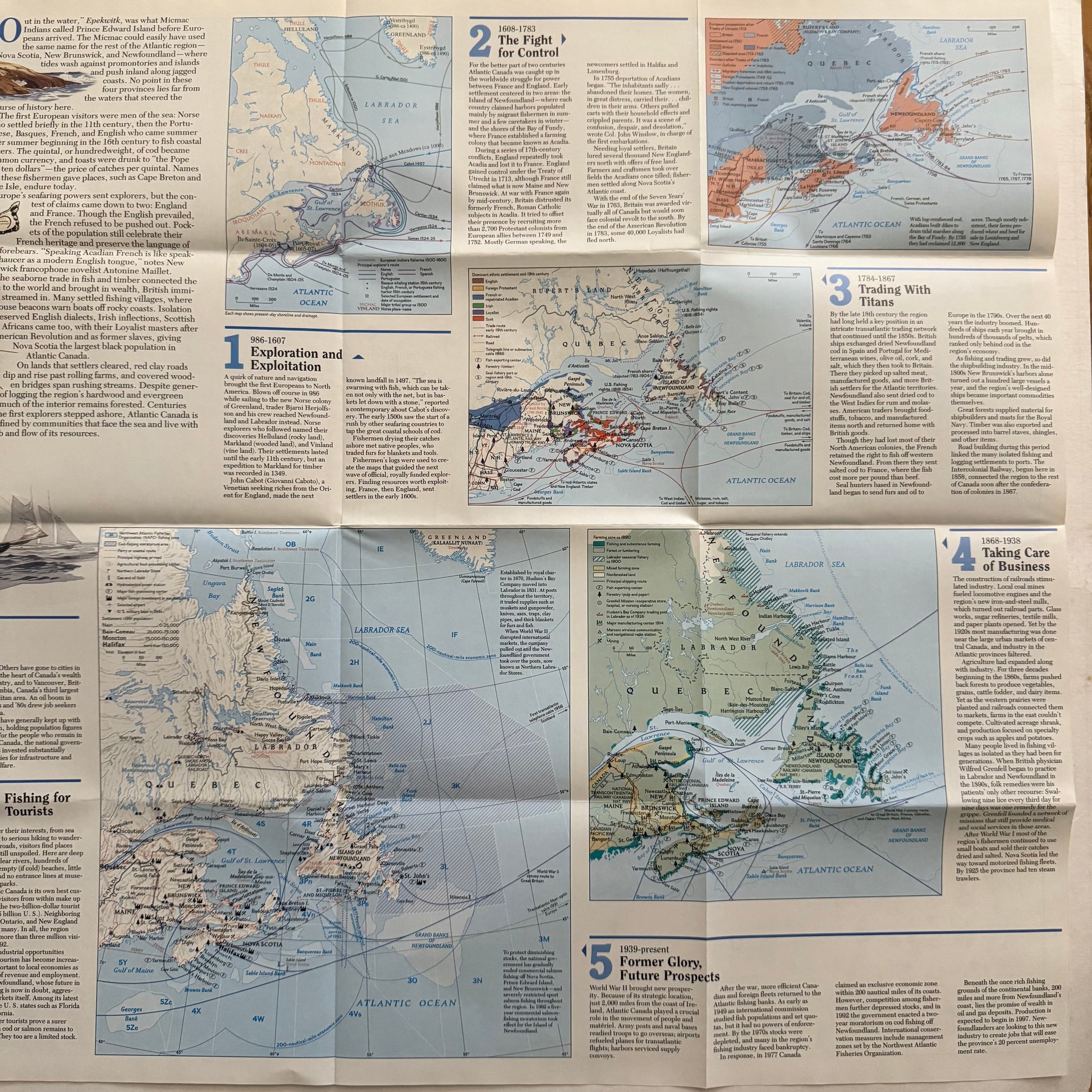
Original 1993 National Geographic map titled “The Making of Canada: Atlantic Canada.”
This richly illustrated fold-out map details the maritime provinces — Nova Scotia, Newfoundland, Labrador, Prince Edward Island, and New Brunswick — along with their history, geography, and early exploration routes.
Beautifully printed in full color with classic National Geographic cartographic design, this piece is perfect for framing or for any map and travel collection.
Details:
- Publication: National Geographic Society
- Date: October 1993
- Size: approx. 27” x 20.5” (unfolded)
- Condition: Excellent vintage.
- Features: Historic maps, coastal illustrations, exploration routes, Champlain portrait