

1940s Pacific Naval Operations Map — Original WWII-Era Fold-Out Print
1940s Pacific Naval Operations Map — Original WWII-Era Fold-Out Print
Regular price
$38.00 USD
Regular price
Sale price
$38.00 USD
Unit price
per
Shipping calculated at checkout.
Couldn't load pickup availability
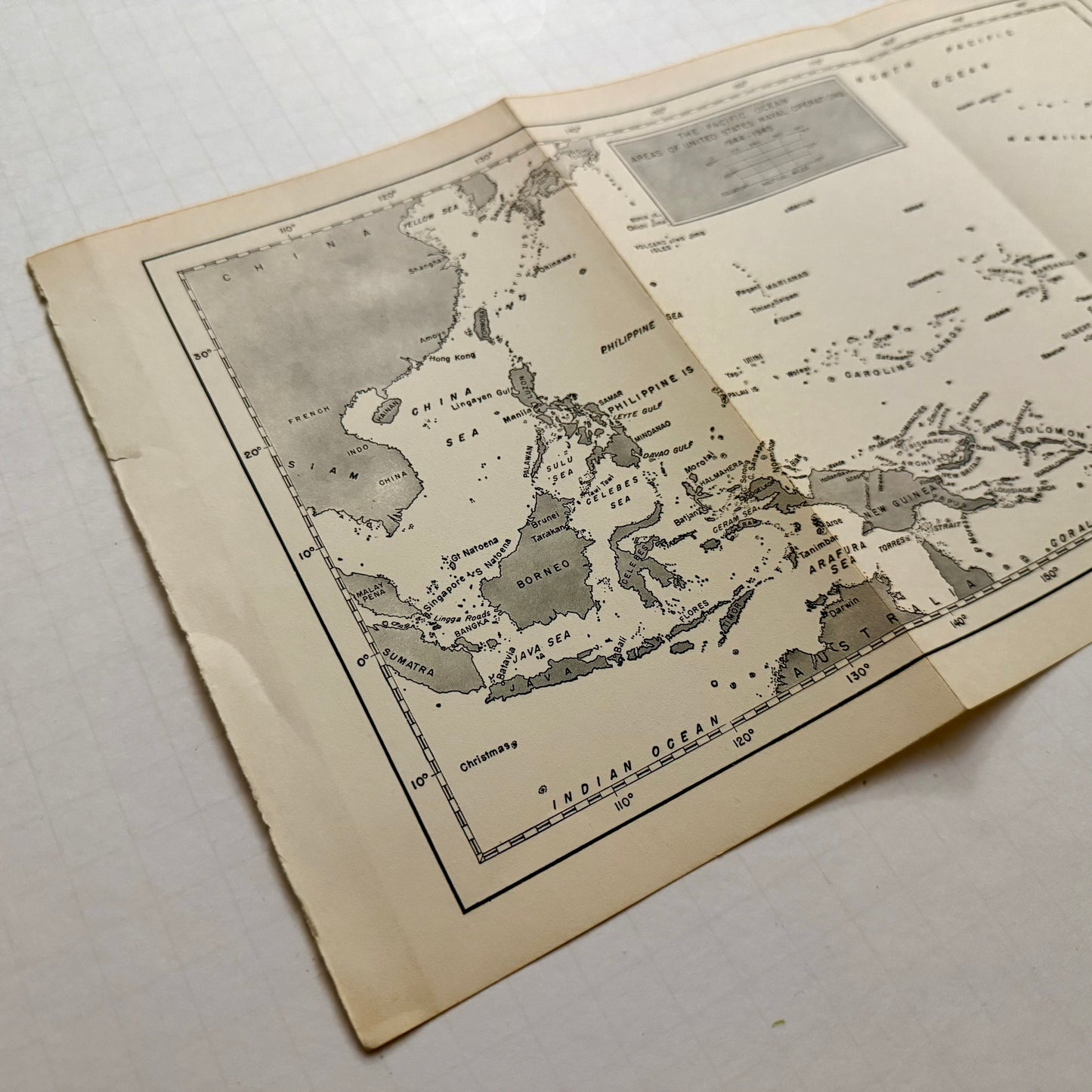
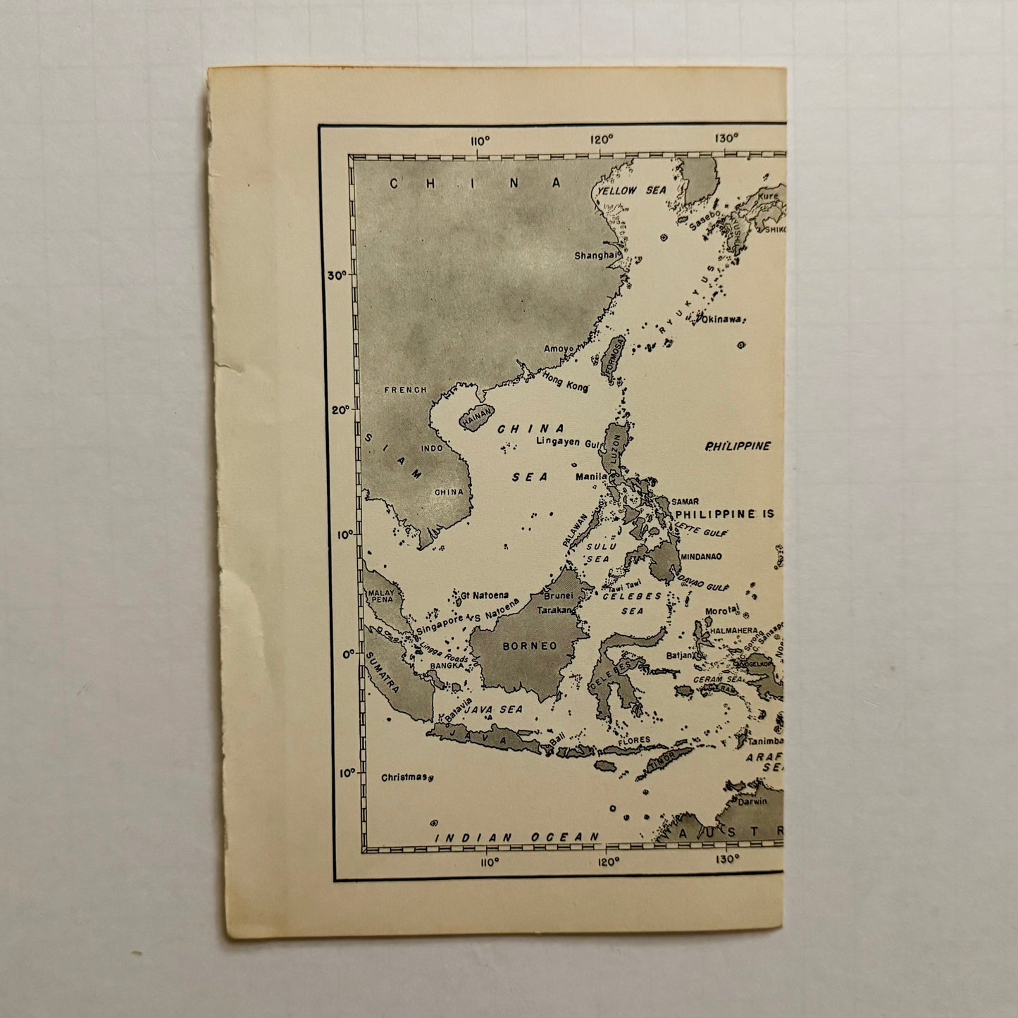
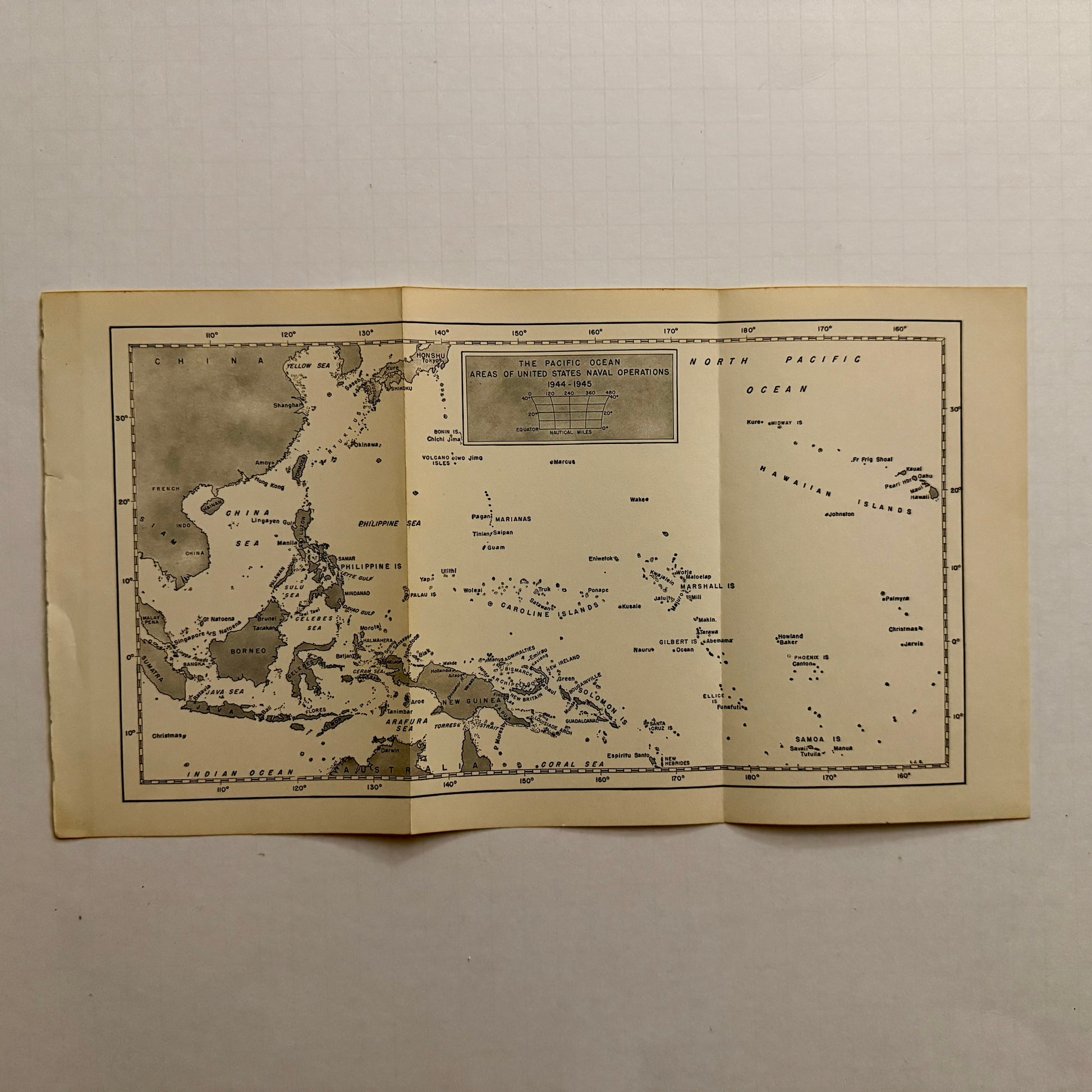
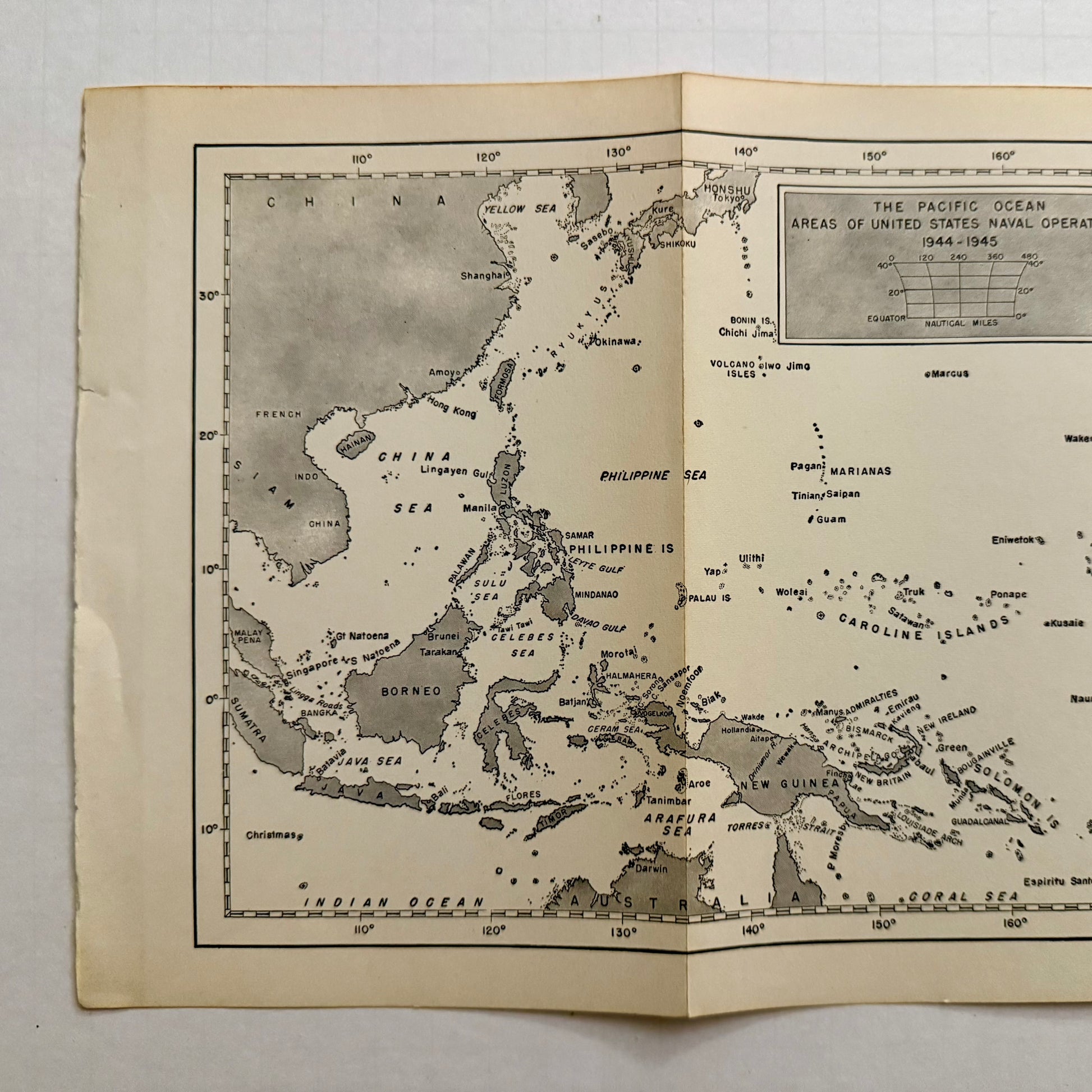
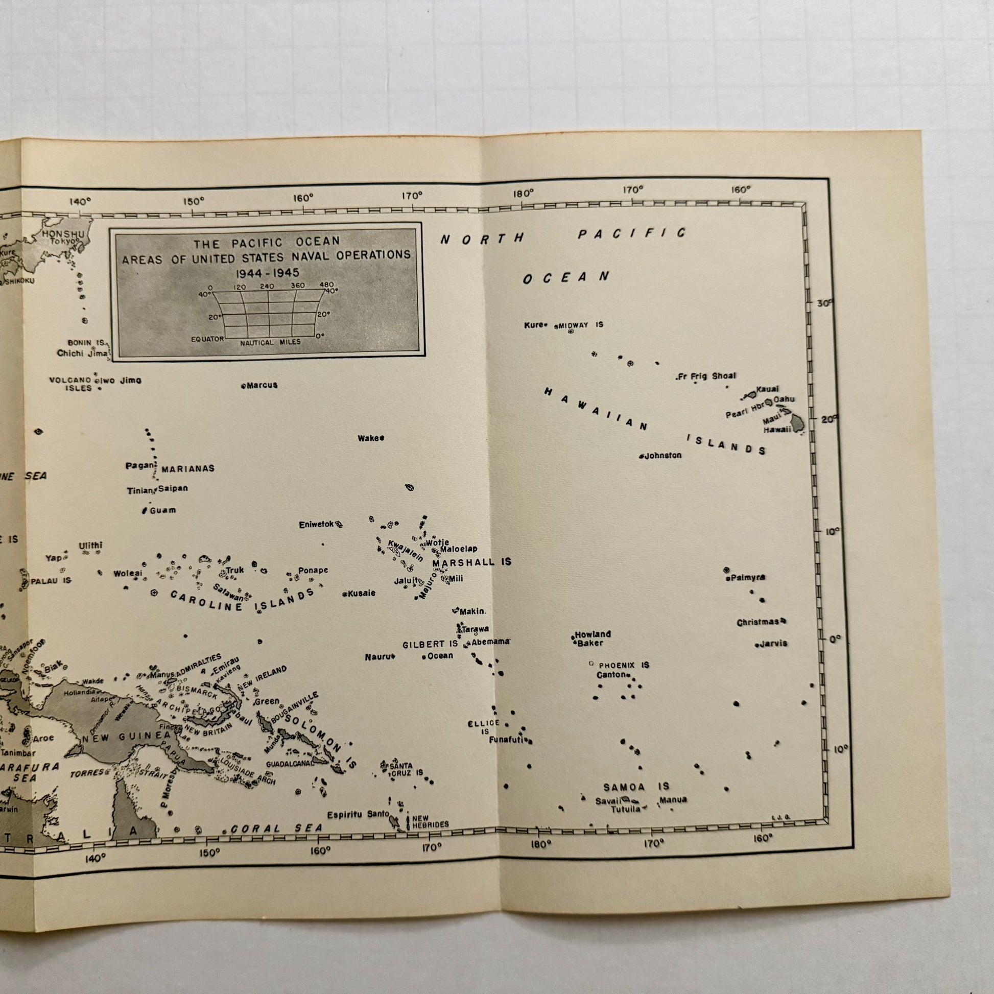
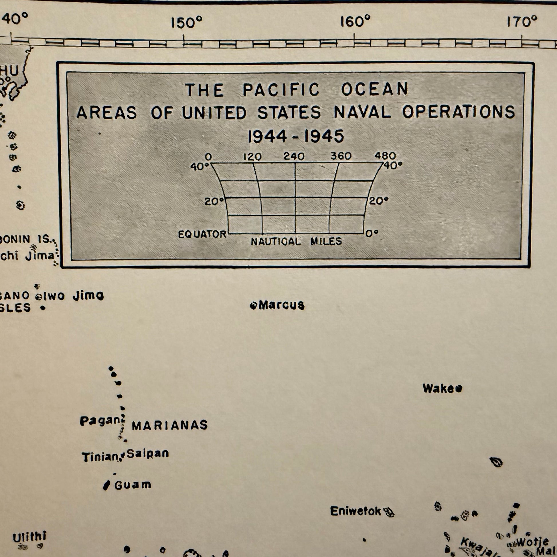
Step back into the era of World War II with this authentic vintage map, “The Pacific Ocean: Areas of United States Naval Operations, 1941–1945.”
Originally published as a fold-out reference in postwar naval history volumes, this map traces the vast theater of U.S. operations across the Pacific — from the Philippines and New Guinea to the Caroline, Marshall, and Solomon Islands.
Printed on aged ivory paper with precise cartographic detailing, this historical piece captures the geography that defined an entire chapter of world history. Perfect for collectors, history enthusiasts, and lovers of antique paper ephemera.
Details:
- Original mid-century fold-out map (not a reproduction)
- Approximately: 8” x 5.5” (folded) and 15” x 8” (unfolded)
- Source: U.S. Naval historical publication, circa 1946–1955
- Condition: Excellent vintage; mild toning consistent with age
- Ideal for framing or display in study, library, or gallery wall